TERRITORY


TERRITORY 

BY ÁLVARO DOMINGUES

“As a graphic register of correspondence between two spaces, whose explicit outcome is a space of representation, mapping is a deceptively simple activity. To map is in one way or another to take the measure of a world, and more than merely take it, to figure the measure so taken in such a way that it may be communicated between people, places or times. The measure of mapping is not restricted to the mathematical; it may equally be spiritual, political or moral. By the same token, the mapping’s record is not confined to the archival; it includes the remembered, the imagined, the contemplated. The world figured through mapping may thus be material or immaterial, actual or desired, whole or part, in various ways experienced, remembered or projected. (…) [Maps’] apparent stability and their aesthetics of closure and finality dissolve with but a little reflection into recognition of their partiality and provisionality, their embodiment of intention, their imaginative and creative capacities, their mythical qualities, their appeal to reverie, their ability to record and stimulate anxiety, their silences and theirpowers of deception." Denis Cosgrove1

There is nothing like going back to Prehistory to feel the true primeval fascination that maps have. If we have the feeling, nowadays, that maps don’t embrace the complexity of the real world, maps of ancient times and territories, indecipherable as they are, free us from that strain and make us more willing for the register of pure representation.

Maps, just like any other representation, carry with them reality and the minds of men and their way of thinking. While some will try to decipher the graphics of paths, rivers, water springs, fields and other physical spaces of the works and days, others will find magical meanings, cosmic signs or just a combination of lines, circles and dots. As we don’t have any other records of the time and culture that has produced the representation of the Valcamonica “map”, interpretation will always be highly precarious and hopelessly bound by rationalities that are surely not the ones who have drawn it.2 We don’t know what it represents or even what was meant to be represented.

Maps are always to some degree “terra incognita”; disclosing and hiding what you intend to objectify and everything else that escapes that simplification. In 16th-century Europe, among the narratives of newly discovered lands and the “findings” of the navigators, the learned knowledge of cartographers, information and misinformation, there were endless problems and contradictions that had to be represented: the antipodes, the sea that boiled in the Torrid Zone, the tracts of inhabited land (the ecumene), longitude calculations, the representations of the world by ancient authors and by the medieval imaginary, the Eldorado, the Amazons and other mythical inhabitants from the ends of the earth, the bizarre, the monstrous and the exotic, and so on. Everything led to an intense cartographic production, a sense of bewilderment coming from the knowledge of the new limits of the world and of its wonders. Cartography was like “painting the world” [a “pintura do mundo”3]: “(…) a map is ‘a social construction of the world expressed through the medium of cartography’. Far from holding up a simple mirror of nature that is true or false, maps redescribe the world – like any other document – in terms of relation of power and of cultural practices, preferences and priorities. What we read on a map is as much related to an invisible social world and to ideology as it is to phenomena seen and measured in the landscape. Maps always show more than an unmediated sum of a set of techniques”.4 

Using cartography to talk about territory means to accept the game of mirrors between reality and representation, according to the well-known formula in photography and in the mind of the photographer – as in the case of Joan Fontcuberta, where we can see that reality is the only part of fiction that we can prove it is there, presented as real. Thus, to fictionalize reality is a requirement without which reality remains opaque and indistinct, therefore, nonexistent.5 The same is stated in Roland Barthes’s thesis, where the camera lucida is a mediator capable of organizing meanings for the chaos in reality.6

The relationship between photography and cartography is pretty obvious: the representation of reality relies on choices, codifications, conventions, protocols, observation tools, where reality itself melts away. This filtering process, of (re)cognition or strangeness, but also of building a collective consensus on the way we look and interpret, continues in the modes of distribution and reception of those representations. Sign, signifier and signified proceed in a somewhat complex path, confirming that we can only interpret images by using memories of other images.

The question of fiction and representation is particularly relevant here since it is not possible to create a “fact” or a statement of facts that can define territory. Within the polysemy that defines the subject territory or the adjective territorial, or even the verb to territorialize, everything ends up being related to territorialized matters, that work as devices for creating meaning, as narratives about who we are collectively, how we live together, how we show our well-being and distress in that life together. That is why territory is recurrently in crisis.

Regarding the crisis of objectivity about what “nature” and “natural crises” may be, Bruno Latour insists on the distinction between matters of fact and matters of concern. In the first case, “facts” would be pure objects, things, “risk-free”, discreet, with clear boundaries, with their qualities and content perfectly recognizable by their essential properties – It belonged without any possible question to the world of things, a world made up of persistent, stubborn, non-mental entities defined by strict laws of causality, efficacy, profitability, and truth7. In the case of matters of concern, on the contrary, facts do not hold that purity; they are entangled in a web of controversies, circumstances and contexts which they reveal and which they are part of. B. Latour states the case of the controversy around the use of asbestos in Fibre Cement: as a crystal-clear scientific fact, asbestos’s physical and chemical properties, when out of the aseptic labs equipped for science, are entangled in a web of questions. The factual properties of the material (highly resistant to traction, fireproof, not subject to chemical decomposition, non-oxidizable…) turn to a “hairy stone” entangled in countless public health issues, business interests, engineering issues, etc.: “once an ideal inert material, it became a nightmarish imbroglio of law, hygiene, and risk. This type of matters of fact still constitutes a large part of the population of the ordinary world in which we live”8. As Latour ironically adds, these types of occurrences – the most frequent when it comes to arguing about the outcomes of science, the way those outcomes are explained and, above all, employed – are like weeds having their way in a French garden, with its perfectly trimmed modern, plain, clean bushes blurring the landscape.

This image is an example of how much more complex it is (the illusion of) objectifying “territory”. Besides the heavily entangled array of scientific “facts” that territory holds – a true wikipedia of Nature, from particle physics to the indeterminacy theory, that alone would be enough to become a shaggy, hairy business –, political ecology feels the need to bring out the political dimension in the territory as a battlefield between humans and non-humans: “When the most frenetic of the ecologists cry out, quaking: ‘Nature is going to die’, they do not know how right they are. Thank God, nature is going to die. Yes, the great Pan is dead. After the death of God and the death of man, nature, too, had to give up the ghost. It was time: we were about to be unable to engage in politics any more at all”9.

We have to imagine cartography as the representation of “territorial facts”. At the same time, we have to think of how far we are in terms of acknowledging the difference between reality (as a collection of facts) and fiction (as representation or even making up facts), and how little we know about what is represented and representation itself and, above all, what one thing does to another.

This game of mirrors is particularly clear in the hybrids facts/narratives/representations about “the city” and in the permanent crisis in which the “city” (for some an undeniable, crystal clear, quasi-timeless fact; for others an endless poetic overflow) got itself muddled up. In direct proportion, the distance between the “good urban shape” imagery and urbanization in its multifarious morphologies deepens. That’s why cartographic representation remains inaccurate, although the clarity and easy access to satellite images, to all the evidence of Google Earth, or even to GIS, Geographic Information System. Moreover, the illusion of accuracy and thoroughness of GIS has turned cartography into a high-resolution unknowledge tool, a black box that records everything and, as such, manipulates everything according a hierarchy of facts and relations between physical, metaphysical, natural and supernatural facts.

This crisis, measured by the widening gap between reality and representation, becomes even greater when the way we look at things is contaminated by “reason”, as a normative attitude committed to order all urban facts in a single uniform narrative – namely the narrative of urban planning and its lexicon, taxonomies, its reasons, institutions, simplifications, beliefs, to name just a few.

That’s how territory is. If we replace the thing by any of its traces – which is in itself an exercise where images, representations, perceptions, content, signifiers, signifieds, and also simplifications are expanded, – the illusion of consensus (just like the persistence of the controversy), sanction the continuous existence of things, realities and fictions that were summoned for that purpose. The overabundance of matters that feeds territory’s vague concept10 has an exponential relationship with the proliferation of meanings and controversies – the true fundamental substance of territory11.

The (pseudo-)concepts of territory inhabit a web of connections that define them, as in the case of the matters of fact/matters of concern that we have seen before. So, when we ask questions about the unstable meaning of territory, we should also be questioning its role and what is conveyed by the discourse on territory and its representation: who are its interlocutors and in what context, what conflicts are hidden behind the words or images and what individual or collective concerns go along with it; who is the speech addressed to and under what reasons or even who is put aside or just simply ignored.

Although the telluric meaning that usually comes attached to it, territory or territories are like Aristophanes’s clouds: they can assume any given shape, they can change themselves, and they can be ethereal, generous or even threatening; they can ultimately be nothing but rhetoric, vague and transient figurations to seduce both the wind and the listeners.

Thus, territory becomes an intelligibility and reality-reading device of extreme voracity; it is omnivorous. It feeds of almost everything and has the advantage of rendering visible (showing or representing it as an objectification strategy in itself) any matter subjected to a process of “territorialization” (as for instance, the equivalent to mis en paysage12 in the debate about landscape). The means used by these signification processes travel a long way, ranging from “artialization”13 – see the diversity of authors, genres, themes, etc. in photography – to numerous “scientification discourses”. In the wide and structured field of science, these find several instances and platforms of belief and legitimation and, in environmental issues, they find a powerful political argument with great social acceptance, at least of its most general statements.

However, the inevitable ever-changing nature of territory – as well as the supposed “deterritorialization”, which is nothing but the name given to multiple ruptures and metamorphoses in the endless building-process of territoriality – provides it with unstable, fragile, vulnerable, conflicting contents, which can be highly dramatized. The permanent tension between preservation/destruction, stability/threat, pleasure/discontent, acceptance/denial, uncertainty, etc., creates a similarly endless tension, which finds in its own social diversity and contradiction a source of agonic consciousness and rationality, eager for confrontation, negotiation, normativity, imposition, penalty,… in order to regulate this conflicting relation14.

This is why political practices and discourse on territory are extremely useful to understand what is really at stake when we talk about territory and how to act upon and through territory. The politicization of territory makes it possible to socially and geographically re-centre the idea of “public space” as a device of argument and conflict, of implication/belonging to a social collective, of negotiation and deliberation of issues, actors, social structure of current fields, arguments, powers and counter-powers, of those who are implicated and excluded, of the action of the State upon matters of provision and regulation of goods and public services, of the commodification of landscape, of the media involvement, of the “places/territories” of landscape. Conflict and war are some of the most radical expressions of the territory as an arena for political dispute15.


1 Denis COSGROVE, ed.(1999) Mappings, Reaktion Books Ltd, London, p1-2

2 Catherine Delano SMITH, (1982), The Emergence of “Maps” in European Rock Art: a Prehistoric Preoccupation with Place, Imago Mundi, Vol.34, pp. 9–25. A. FOSSATI 2002, Landscape Representations on Boulders and Menhirs in the Valcamonica-Valtellina Area, Alpine Italy, in G. NASH & C. Chippindale (eds.), European Landscapes of Rock-Art, Routledge, London, pp. 93–115. Emmanuel ANATI (s/d), “The way of life recorded in the Rock Art of Valcamonica”, http://www.ssfpa.se/pdf/2008/anati_adorant08.pdf in www.rockartscandinavia.se/pdf/2008/anati_adorant08.pdf. See also E. ANATI (2008), The Civilization of Rocks, Capo di Ponte – Edizioni del Centro Camuno di Studi Prestorici, Brescia.

3 BPMP, Biblioteca Pública Municipal do Porto (1992), A pintura do mundo: Geografia portuguesa e Cartografia dos séculos XVI a XVIII: catálogo da exposição, Câmara Municipal do Porto, Porto. Jean-Marc BESSE (2003), Les grandeurs de la terre: aspects du savoir géographique à la renaissance, Ed. ENS, Paris.

4 J. B. HARLEY (2001), The New Nature of Maps. Essays in the History of Cartography. Baltimore: The John Hopkins University Press,. p.35–36 in Daniela M. FIALHO (2006), “Arte e Cartografia”, Seminário Arte e Cidade, PPG-AU – Faculdade de Arquitetura / PPG-AV – Escola de Belas Artes / PPG-LL – Instituto de Letras,

S. Salvador da Baia in www.arteecidade.ufba.br/st3_DMF.pdf. See also J.B. HARLEY; David WOODWARD (1987) (eds), The History of Cartography, Volume 5: Cartography in the Nineteenth Century, Chicago and London: University of Chicago, pp.5/36

5 Cf. Joan FONTCUBERTA (1997), El Beso de Judas – Fotografía y Verdad, Ed. G.Gili , Barcelona 1997, p.17.

6 Roland BARTHES (1980), La chambre claire: note sur la photographie, Cahiers du cinéma, Ed. Gallimard – Le Seuil, Paris. Roland BARTHES (1967), “Sémiologie et Urbanisme”, in L’Aventure Sémiologique, Ed. du Seuil, Paris, 1985.

7 Bruno LATOUR (2004), Politics of Nature, Harvard University Press, London, pp.22-24 (1st ed., Paris, 1999).

8 Idem, ibidem, p.23.

9 Idem, ibidem, p.25-26.

10 Alain BOURDIN (2011), O Urbanismo Depois da Crise, Livros Horizonte, Lisboa.

11 For a similar discussion regarding “landscape”, see Álvaro DOMINGUES (2012), Paisagens Transgénicas/Transgenic Landscapes, in P BANDEIRA; P. CATRICA (ed), Missão Fotográfica Paisagem Transgénica, EAUM, FCG, Guimarães 2012, Imprensa Nacional Casa da Moeda, Lisboa.

12 Pierre DONADIEU (2002), La société paysagiste, Actes Sud – ENSP. Cf. Bernard DEBARDIEUX (2007), “Actualité politique du paysage”, Revue de Géographie alpine, n.° 4, on the “empaysagement des sociétés occidentales”.

13 ROGER, A. (1997), Court traité du paysage, Ed. Gallimard, Bibliothèque des Sciences Humaines, Paris.

14 Cf. José Manuel Martín MORILLAS (2003), Los sentidos de la violência, Universidad de Granada, Granada.

15 João FERRÂO (2011), O Ordenamento do Território como Política Pública, Fundação Calouste Gulbenkian, Lisboa. Anne SGARD (2002) “Le paysage dans l’action publique: du patrimoine au bien commun”, Cahiers de Géographie du Québec, déc. 2002, n.° spécial, vol. 46, n.° 129. Yves LACOSTE (1976), La géographie, ça sert, d’abord, à faire la guerre, Maspero, Paris.


see the entire article in the issue 3 of scopio international photography magazine: territory


LA MAISON EST UN HABITAT A DEMECANISER


LA MAISON EST UN HABITAT A DEMECANISER

   BY NUNO GRANDE

The sentence that provides the title for this article is engraved in the ceiling of Casa do Conto’s loft, a renewal project for “arts & residence”, urdertaken in Porto by the architecture atelier Pedra Líquida, to which I am associated. As it can be easily understood, the title comes from the well-know epithet by Le Corbusier – la maison est une machine a habiter –, and it tries to “deconstruct” it by antinomy. (Re)created by me, the title sentence encloses other mes- sages, from other authors, about the concept of “house” or about the story of “that” house in particular1, which are also engraved on different ceilings there. Curiously, the idea for my textual contribution arose far from Porto’s environment: it occurred to me in 2009, on a visit to Veit Stratmann’s house, located in the Parisian Beaubourg, near Centre Georges Pompi- dou. This artist lives in a modest loft apartment, in a residential quarter which offers combined spaces for housing and for atelier at reasonable prices and in a flexible way. The quarter was planned during the urban reconversion of Marais, from the mid-1970s on, in order to desacral- ize the architectonic and urbanistic principles inherited by modern functionalism (as in Centre Georges Pompidou’s project), and to repopulate – or “gentrify” – the Marais with new inhabit- ants associated with the world of cultural creation and consumption.

Thus, in the city where Le Corbusier wrote his well-known epithet, around the 1920s2, the pre- text for undergoing its conceptual “deconstruction” arose: it doesn’t make sense anymore to look at a house as a standardized and monofunctional life machine, like the Modern Move- ment instructed. On the contrary, a house, whatever its dimension may be, must be a place of multiple possibilities, interactions and sequences between different life circumstances. Veit Stratmann’s studio, in Paris, is exactly like this; Casa do Conto, in Porto, will hopefully be like this.


This personal account emerges from the current debate over the process of urban and archi- tectonic rehabilitation of Porto’s downtown, and over the public policies behind it or that should be behind it. In the last decade, and using the slowness and inefficacy of previous public inter- vention processes as a pretext, the political rhetoric has refocused on the idea that the private real estate market should be the one to regulate rehabilitation standards and to define who the target audience to win back for the city’s downtown will be.

In this way, Porto’s Municipality and the Society for Urban Rehabilitation, to which the former is associated (Porto Vivo, SA), have been encouraging generic construction companies – i.e., without a specific tendency to work in the rehabilitation field – to redirect their real estate investments from the new city neighborhoods to the traditional downtown. They do so by acting as a go-between for the purchase and expropriation of several urban proprieties and by promoting the swift approval of their intervention projects. Thus, in recent years, we have seen the transfer of the current real estate promotion logic, i.e. of construction from scratch to urban rehabilitation, through: the intensive demolition of inner blocks, with the scenographic preservation of the main façades; the extemporaneous association of lots; and the construc- tion of houses which are standardized by the market (apartments T1, T2+1, T3, T4...), including, most of the times, parking storeys in the complex interior of those blocks.

The outcome is starting to show: the replacement of the old diversified urban fabric – based on a vertical property laid out into lots – by the new homogenizing and impermeable urban fabric of the blocks, as well as by a new housing offer of horizontal standardized – or “mecha- nized” – property.


COVA DO VAPOR


COVA DO VAPOR

por Álvaro Domingues

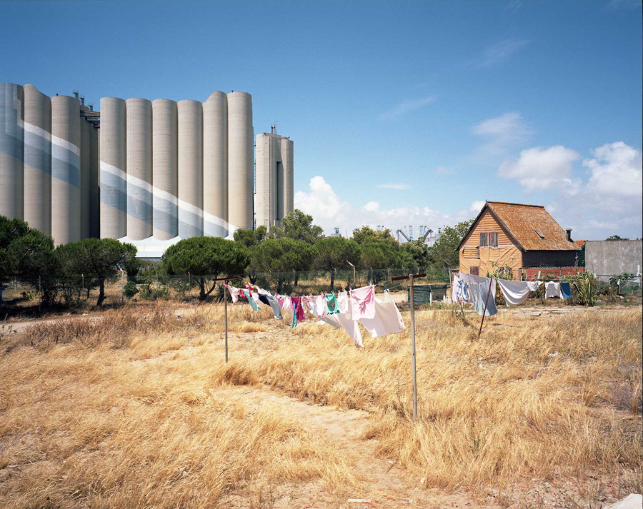
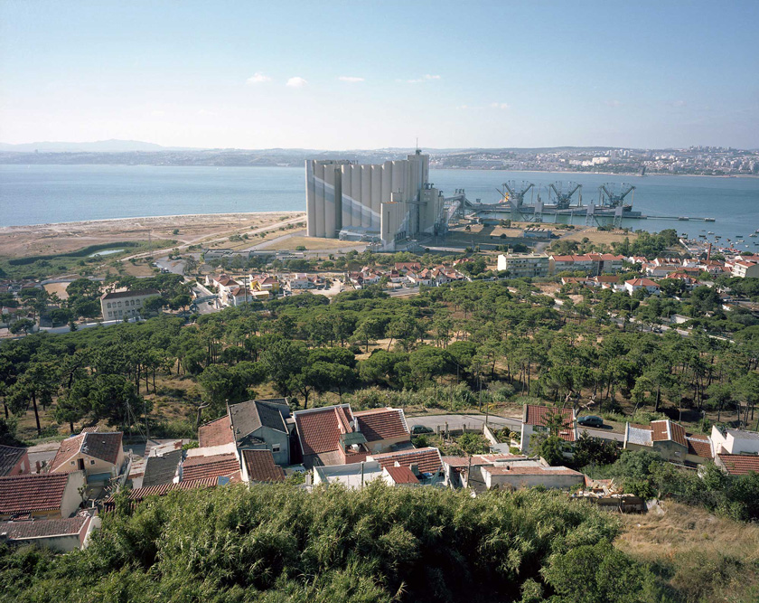
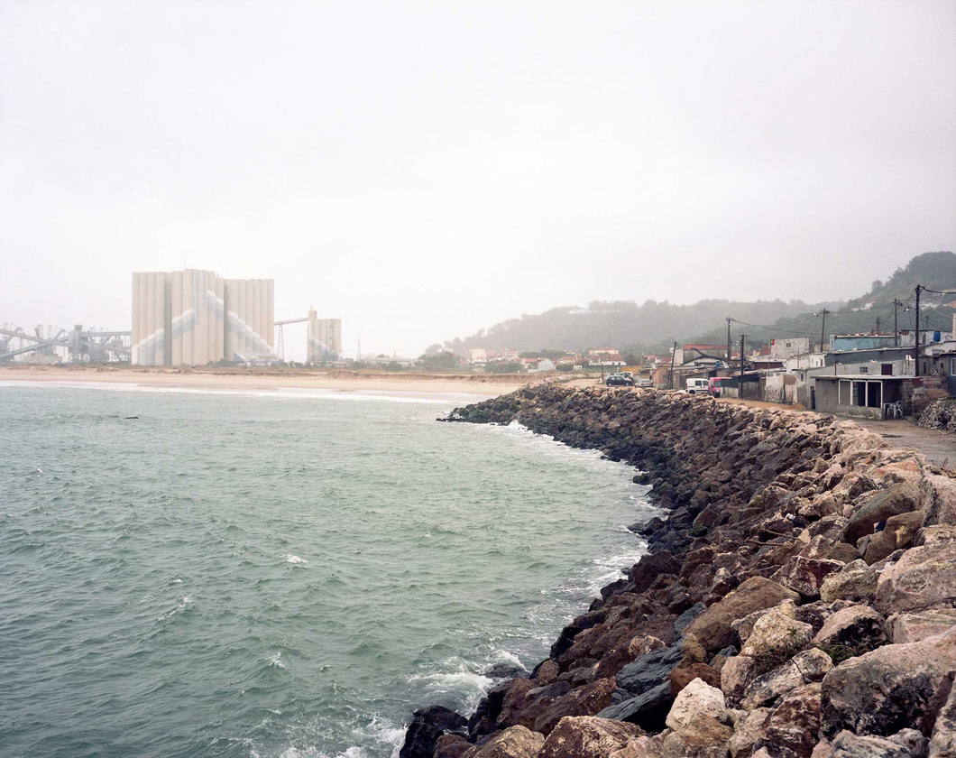
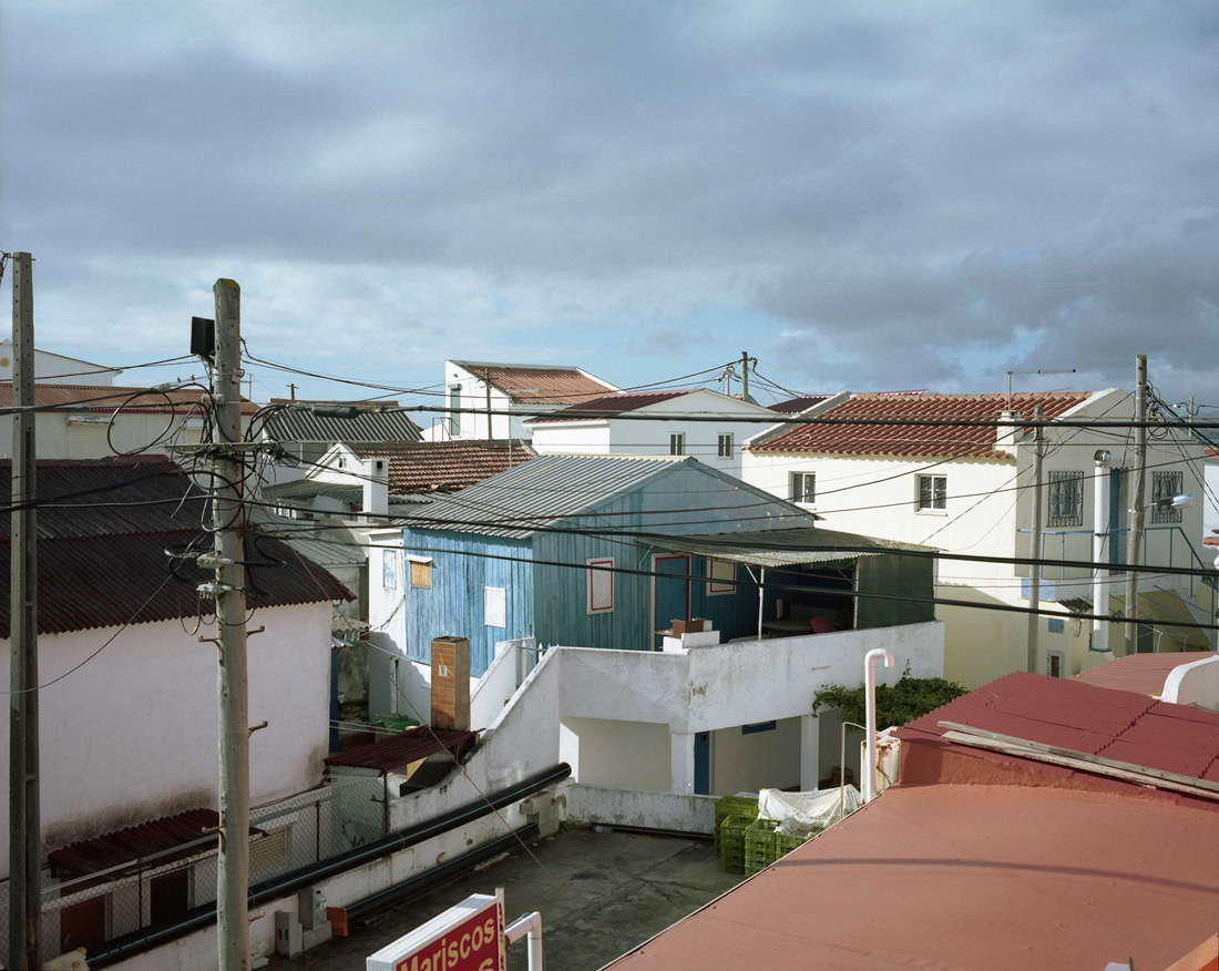
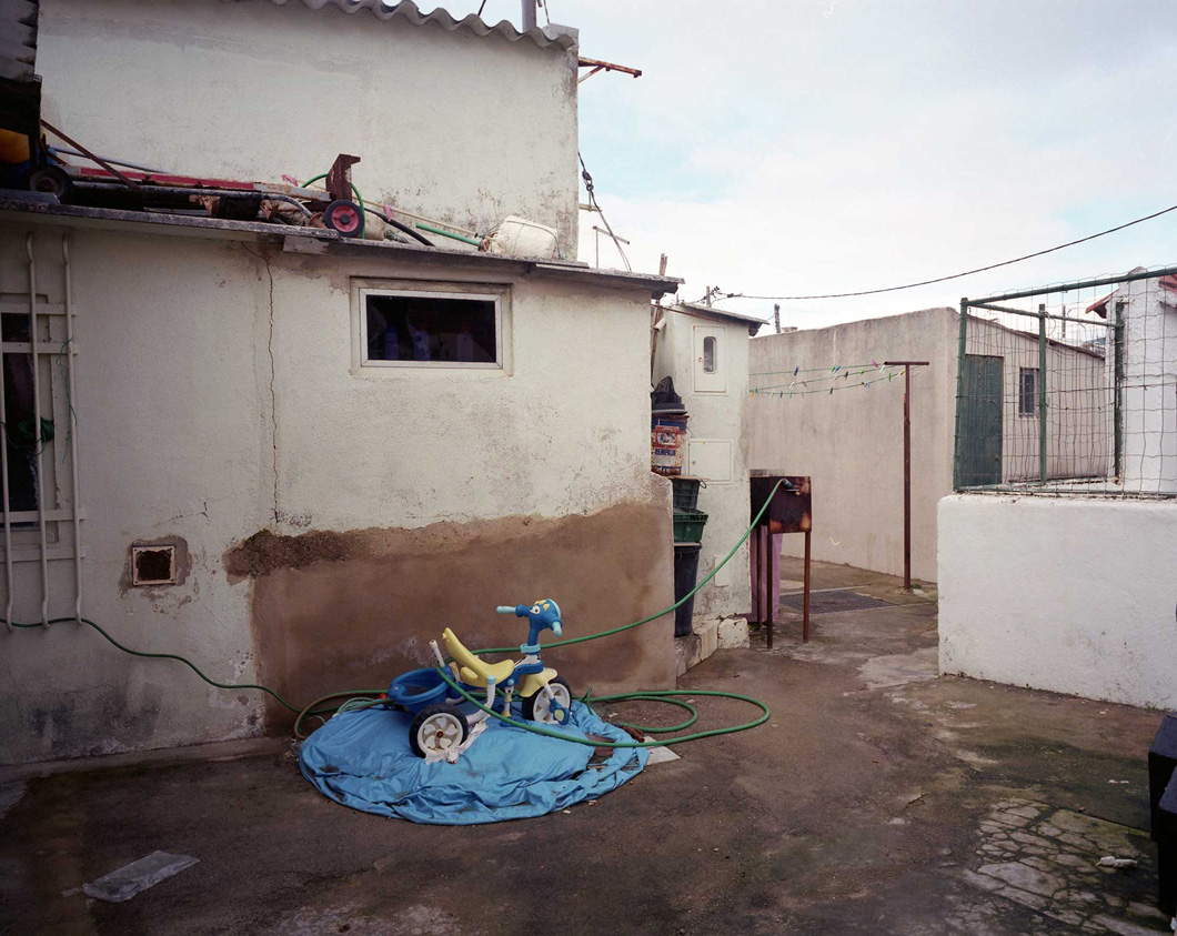
Localizadas no extremo da margem Sul do Tejo, mesmo antes do rio penetrar no grande mar oceano, Trafaria, Torrão, Cova do Vapor, parecem terras indefinidas entre a geografia da realidade e da ficção. Depois de impressionados pela massa cilíndrica dos silos de cereais, altíssimos, excessivos, logo nos perdemos na infinidade das pequenas coisas, barcos e automóveis estacionados lado a lado, gente que deambula, ora simpática, ora furtiva, barulhentos mecânicos de automóveis adaptando as máquinas em prodígios de sons e luzes, crianças ciganas, emigrantes africanos, pescadores, ruínas de fábricas, amontoados de casas apinhadas, precárias ou muito sólidas dentro de muros, materiais diversos, cores, lixo, ruas estreitas de terra e areia, ruas pavimentadas com tudo, papelões, pedaços de tijolos partidos, lajetas de betão. Não se saberia se alguém está a montar ou a desmontar tudo isto.
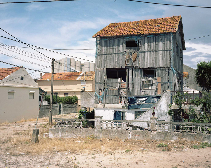
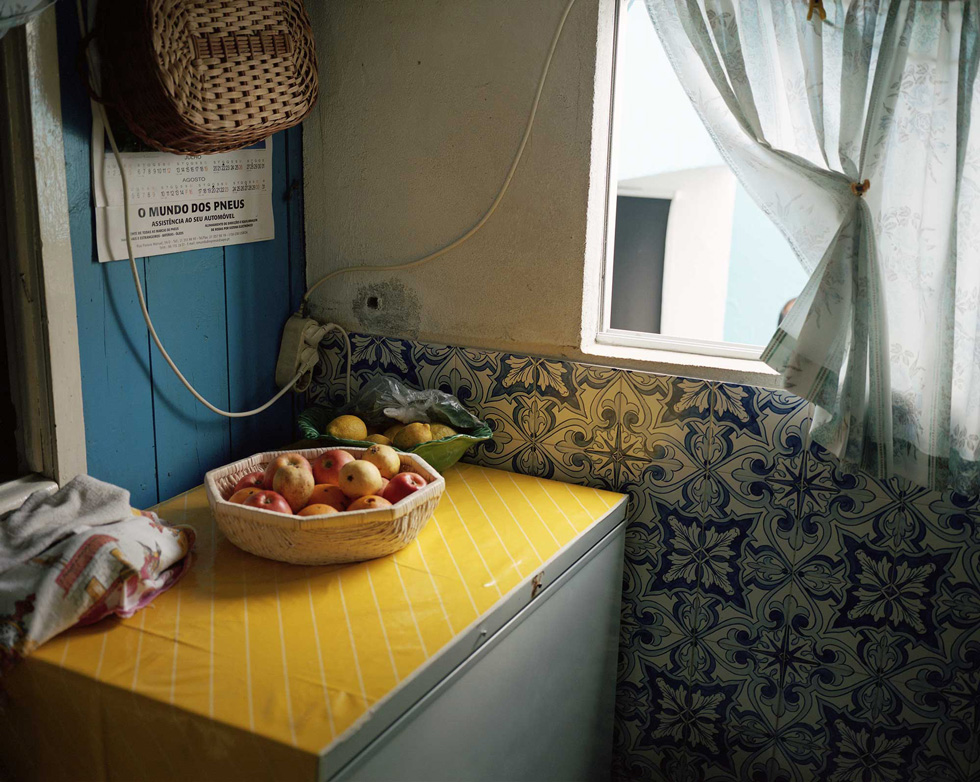
Convivem lado a lado o cuidado ínfimo com as coisas, as tintas frescas, as paredes imaculadas, os vasos de flores, com a ruína, os barracos e as casas devassadas, os carros velhos e a maior diversidade de sucata.
O mar rói as margens e as praias nesta língua de areia que os humanos, o vento, as ondas e as correntes foram mudando desde que há memória do mundo. O avanço das águas e a erosão constituem hoje uma ameaça constante.  

Sobram histórias trágicas destas terras de flutuante condição. O lazareto que lá foi instalado em 1565 é já um sinal da marginalidade e estigmatização.
Nos idos de 1775, um governante déspota e sem escrúpulos que os historiadores se encarregaram de mitificar, o Marquês do Pombal, mandou incendiar a Trafaria, maltratando e prendendo quem escapava e obrigando os homens a irem para o exército. O Marquês sabia que na Trafaria se escondiam, soldados desertores, ladrões e jovens refratários do serviço militar.
Depois vieram as indústrias de conserva de peixe e até uma fábrica de dinamite. A terra prosperou também com a frequência balnear por parte de alguma burguesia lisboeta e até aconteceu de a rainha vir à Trafaria no início de séc. XX inaugurar a primeira colónia balnear em Portugal. Os palheiros dos pescadores passaram a conviver com outras casas de madeira dos veraneantes sazonais vindos dos bairros populares de Lisboa.
Haveria, escolas, banda, coreto, ginásio, sociedades recreativas, bombeiros,  fortes, quarteis e presídios militares. O trabalho na indústria e na apanha da amêijoa misturava-se com os “banhistas”.

A moda de “ir a banhos à Trafaria” inaugurou a carreira do barco a vapor de onde vieram os topónimos de Cova do Vapor e Lisboa Praia. A Cova do Vapor foi-se enchendo de casas de madeira que o mar frequentemente destruía, sobretudo a partir dos anos de 1930’. Por isso havia que reconstrui-las e mudá-las de lugar. Algumas eram transportadas por juntas de bois que as puxavam.

De 1946 vem este excerto de Etienne de Gröer, polaco-russo, reputado urbanista e professor do Instituto de Urbanismo de Paris, contratado pelo governo do regime salazarista para fazer planos em Portugal:

(…) Mais para o Norte, além da Mata Nacional, encontra-se a “Cova do Vapôr”, um pequeno porto formado por uma enseada entre as dunas, perto da embocadura do Tejo.

Sobre a língua de areia que se formou entre o rio e o mar, ergueram-se minúsculas barracas de madeira, sobre estacaria, construídas nas parcelas das dunas que alugou aos seus proprietários a direcção do Porto de Lisboa. São casas de fim-de-semana ou de “camping”.

Lamento ter de dizer que tudo isto foi construído na maior desordem possível: as casinholas estão demasiado perto umas das outras e apresentam, no seu conjunto, o aspecto de uma aldeia de pretos. Não têm nem água, nem esgotos.

As águas usadas e tudo o resto deita-se na areia, que se torna progressivamente insalubre e de mau cheiro.

Antes desta pérola sobre a “aldeia de pretos”, o mesmo já tinha escrito que

“A praia da Trafaria não é conveniente para os banhos de mar, pois que as correntes do Tejo trazem para cá e acumulam em frente dela todos os despejos dos esgotos de Lisboa. (…) Construiu-se tudo em grande desordem.

Há um número exagerado de ruas, muitas das quais são demasiado estreitas, e todas elas (ou quase) não tem arranjo nenhum, nem são conservadas de qualquer maneira. Reina em muitos sítios um cheiro desagradável por falta de instalações sanitárias nas casas 1.

Há horríveis barracas, feitas com pranchas e com ferro-velho, e um grande número de casebres de todas as espécies que servem como habitação para uma grande parte da população, que por causa disso sofre de todos os danos físicos e morais. A tuberculose reina aí.”

Não vale a pena insistir. Em 2002, no Jornal Púiblico, José António Cerejo muda radicalmente o tom:

"Cuidada e delicada, feita de afectos que não marcam os bairros degradados das periferias, a Cova do Vapor está longe de ser um bairro de lata ou uma aldeia igual às outras. É uma povoação singular, é um lugar onde tudo é diferente, sem escola, centro de saúde ou vestígio de serviço público, um lugar contraditório, uma relíquia de excepção. São construções mais ou menos precárias, encavalitadas umas nas outras, expoentes de engenho e desenrascanço, às vezes sem se perceber onde é que começam umas e acabam as outras. São casas e casinhas, com apenas duas ruas de terra batida, onde estão as poucas lojas da terra, capazes de deixar passar carros; mas o labirinto dos caminhos serpenteia por todo a parte, com largura apenas para os assadores, para os canteiros da salsa e dos coentros, para um tanque de roupa ou um duche apertado. Às vezes ainda há espaço para umas couves, umas flores, umas árvores de fruto, armários, estendais, e inventivas garagens e anexos de casas." 2

Era difícil que houvesse acordo numa terra que nasceu num lugar onde existia uma fábrica de dinamite; onde o mar, o vento e a areia fazem e desfazem praias e dunas; onde a linguagem e os actos do poder oscilam entre a violência, o pitoresco e a condescendência. É quase um fado, uma maldição que só desaparece com magias e encantamentos que povoem novamente os lugares e o seu imaginário.

Com a expressão francesa Terrain Vague, Ignasi de Solà-Morales3 pretendeu capturar está espécie de luz negra que nos fascina e nos atrai para lugares que estão do lado de fora da racionalidade normativa corrente. A escolha do francês tinha uma intenção dupla: terrain, remete claramente  para  terreno edificado, para um lugar urbano, e vague, possui um duplo sentido de vazio de coisas, vazio de função e, sobretudo, vazio de sentido. Lugares incertos.


La imaginacion romântica que pervive en nuestra sensibilidade contemporânea se nutre de recuerdos y de expectativas. Extranjeros en nuestra própria pátria, extranjeros en nuestra ciudad, el habitante de la metrópoli siente los espácios no dominados por la arquitectura como reflejo de su misma inseguridad, de su vago deambular por espácios sin limites que, en su posición externa al sistema urbano de poder, de actividade, constituyen a la vez una expresion física de su temor e inseguridad, pero también una expectativa de lo outro, lo alternativo, lo utópico, lo porvenir, etc.


A ausência de uso, ou a sua indefinição,o estranhamento, a instabilidade ou baixa intensidade, e o próprio sentido ambivalente da precariedade, da ausência e da ruína – sinal de resistência, apesar de tudo, ou sinal de decrepitude progressiva – seriam ingredientes quase romântico para a construção de uma estética da liberdade, daquilo que pelo seu pouco préstimo está pronto para ser re-imaginado num campo infinito de possibilidades.
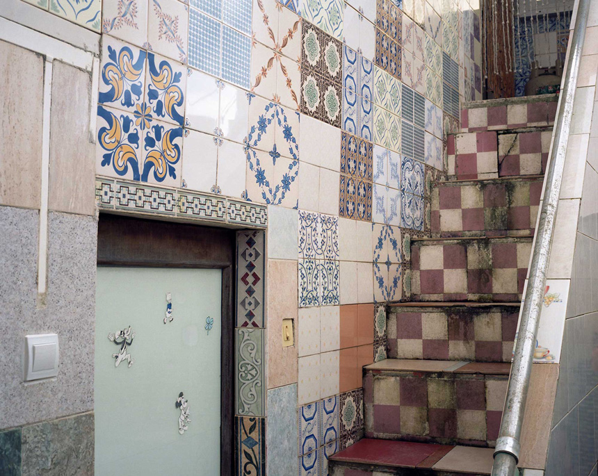
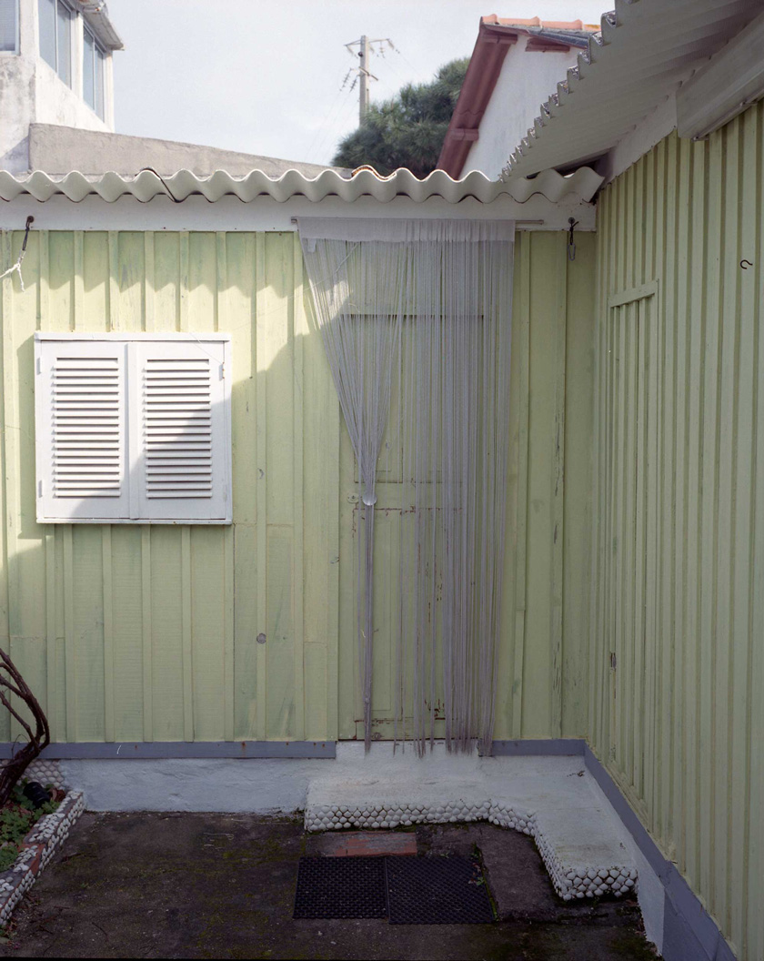
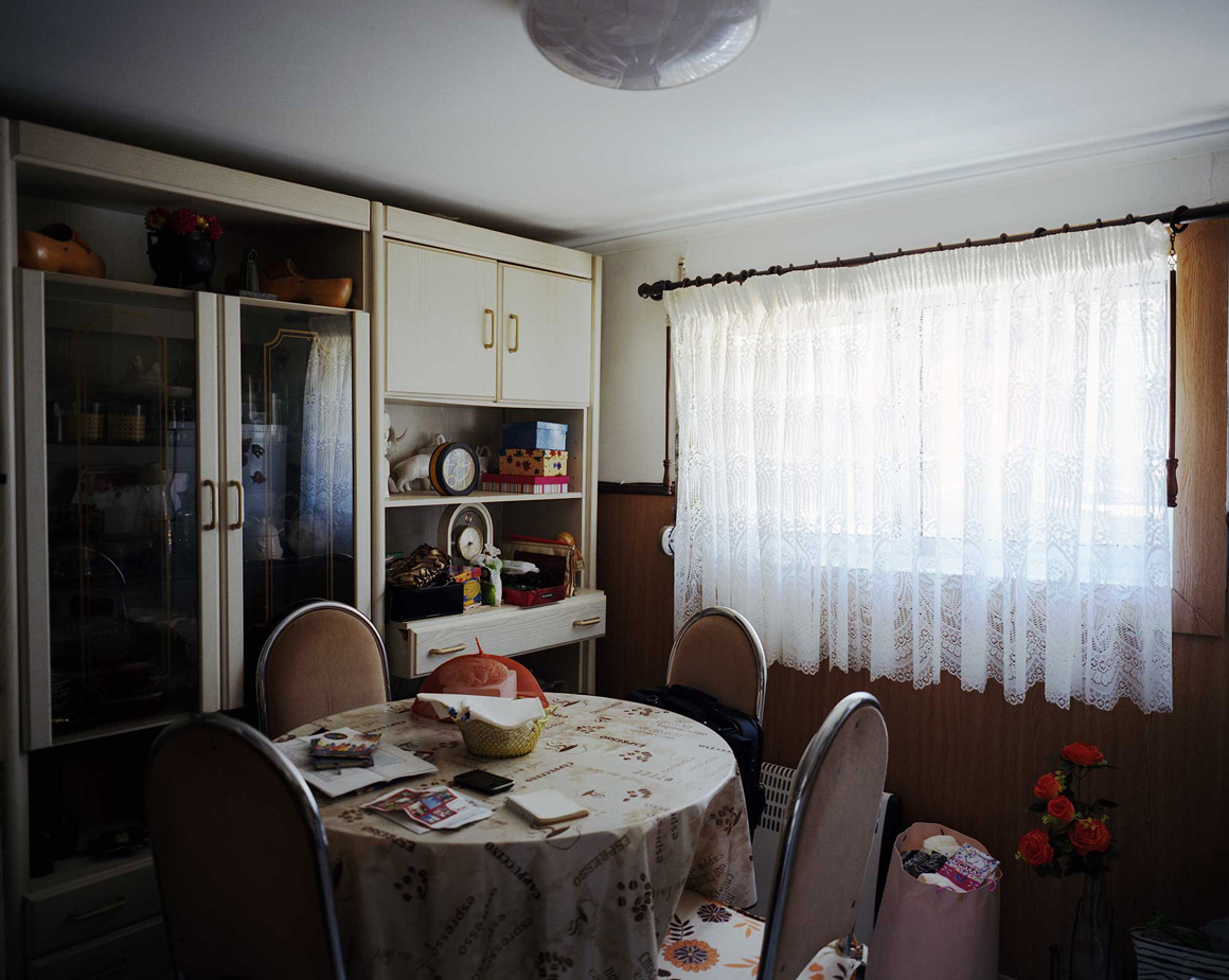
Estariamos longe da obsolescência acelerada e dos seus significados desencantados, apesar dos muitos sinais de abandono que na Cova do Vapor convivem com extremos de minúcia e dedicação nos afectos que as paredes expõem: desenhos com seixos e conchas, mosaicos coloridos, pinturas de barcos e arco-íris, nomes escritos e palavras que designam tempos felizes e mundos perfeitos.

A foto-grafia de Stefano Carnelli surpreende e dá a ver esta ambiência por múltiplos e dissonantes caminhos: sobre erva seca e terra pisada, flutuam cordas com roupa a secar; perto, uma casa simples e bastante degradada, não se sabe se usada ou abandonada; para lá de um renque de pinheiros, a escala desmesurada de um silo composto por um feixe de cilindros como tubos de um órgão gigantesco. As faixas coloridas que percorrem o silo em diagonal, ecoam o azul e branco do céu e das nuvens. Estamos pouco prevenidos para tamanhas dissonâncias.

Sobre este material instável, a fotografia, ao estabelecer um fio condutor entre significados e significantes fotográficos, constrói uma atmosfera própria que permitirá aceder a outras dobras mais escondidas; para uns, românticos, a alma desencantada das coisas, um lamento deslassado, distribuído por indícios, marcas, coisas ausentes ou fora do lugar. Para outros, é exactamente a energia da dissonância, reunindo no mesmo lugar presenças muito afastadas, aproximando-as, que é capaz de expandir os sentidos em direcção à invenção poética da realidade ou à sua expansão.

Por isso, o simples registo das coisas documentadas não é o que mais claramente se revela. O que se desprende são sobretudo sinais, marcadores, caminhos que conduzem a universos maiores e que aqui apenas se insinuam por presenças que por vezes são minúsculos resíduos ou simplificações. É isso que fica liberto para o jogo das emoções.

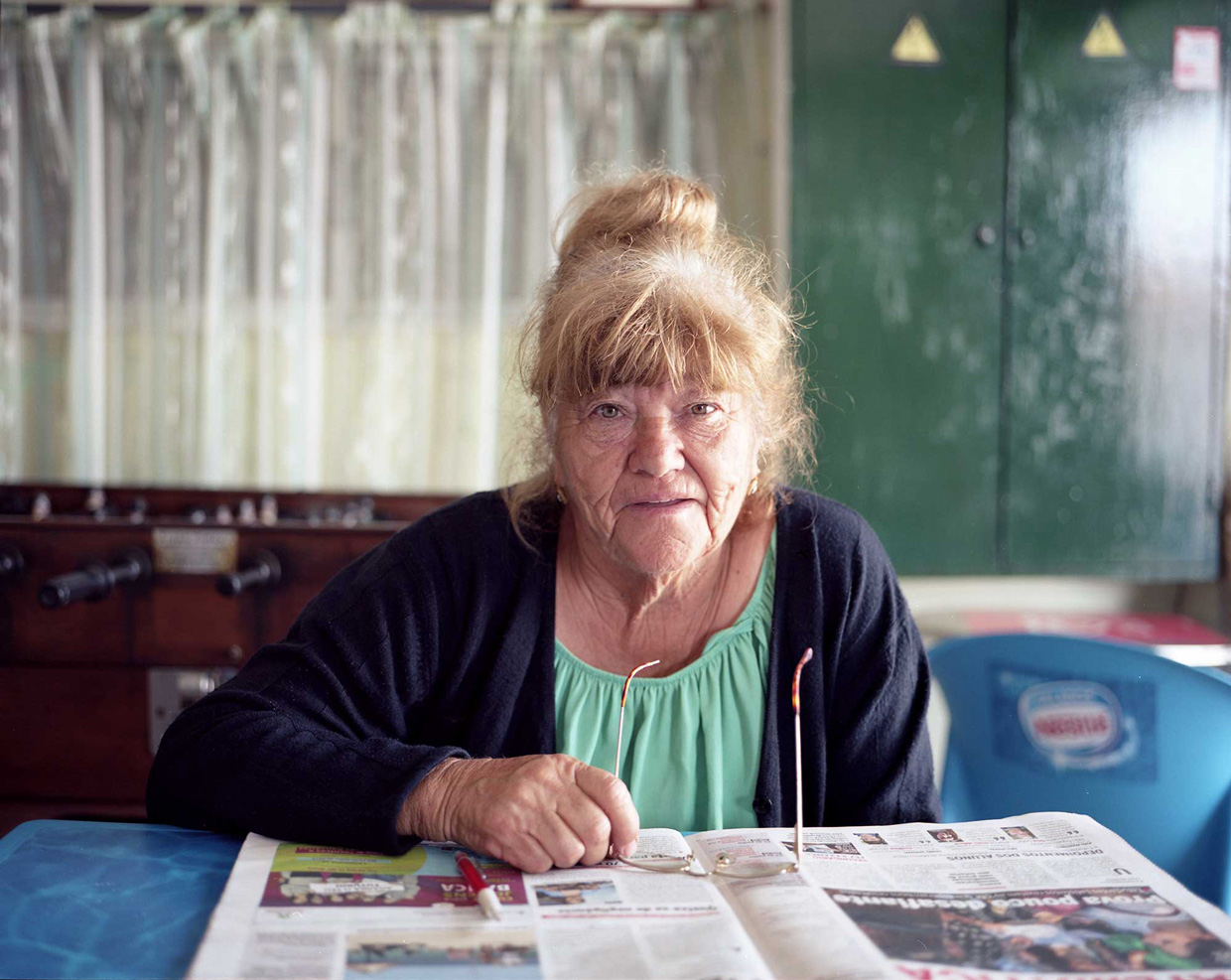
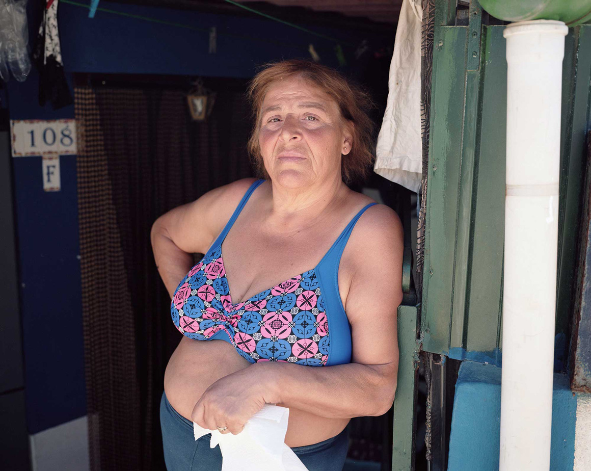
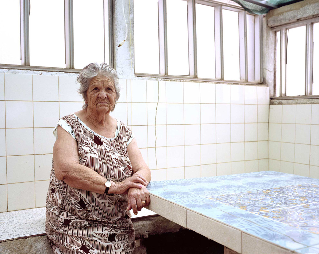
Depois há os rostos, as pequenas coisas dos humanos, as suas casas e os seus sonhos. Tudo parece ao mesmo tempo pobre e rico, simples e complexo, banal e extraordinário, descuidado ou meticulosamente preenchido para que nada escape à intensidade de quem aqui vive e como vive.

São lugares estranhos que parecem fora dos circuitos habituais; aparentemente esquecidos ou residuais, imprecisos, flutuantes ou vagabundos.
Poder-se-ia pensar que são coisas à margem (talvez marginais, também), inseguros por causa dos ataques do mar ou da sensação que ali se acolhem outras ameaças…, mas logo que nos deixamos conduzir pelos rostos das pessoas - esperançosos, alegres ou alheados, como nós -, pela minúcia dos espaços e das coisas domésticas, pela densidade de marcas pessoais, de memórias, de contínuo cuidado pela fragilidade de tudo, paredes, tectos, fios, electrodomésticos…, disso tudo só nos fica a sensação da falta de bens materiais preenchida por tudo aquilo que possa ocupar algum vazio por onde haja o risco de qualquer coisa se desmoronar e, num vórtice, tragar tudo.

Por isso há pedregulhos a defender as ruas de terra batida, tal como há vasos de plantas, bonecos, cores, quadros, recordações, objectos, azulejos…, toda uma saturação de coisas, acontecimentos, memórias, presenças que tenham o poder de afastar esse horror ao desaparecimento.


1 Etienne Gröer (1946), Plano de Urbanização do Concelho de Almada: análise e programa. Relatório., 1946 In Anais de Almada, 7-8 (2004-2005), pp. 151-236.

2 José António Cerejo (2002), Uma Relíquia Chamada Cova do Vapor, PÚBLICO, 28/04/2002.

3 Ignaci Solà-Morales (1995), “Terrain Vagues”, in Anyplace, Anyone Corporation, The MIT Press, N York, pp.118-123. Disponível em https://paisarquia.files.wordpress.com/2011/03/solc3a1-morales_i_terrain-vague.pdf.


BICYCLES IN CHINA


BICYCLES IN CHINA 

by Xiaomeng Zhao

Xiaomeng Zhao 赵小萌(b. Beijing,China, 1987) is a photographer based in between Beijing, China and Toronto, Canada. At the moment he is working on various topics that reflect the current massive societal changes in modern China.


ARTIST'S STATEMENT

China was once known as the "Kingdom of Bicycles." For decades, bicycles were used as the principal mode of transportation and were an essential part of Chinese lifestyle. The bicycle was both a cultural symbol and a shared memory for many generations.

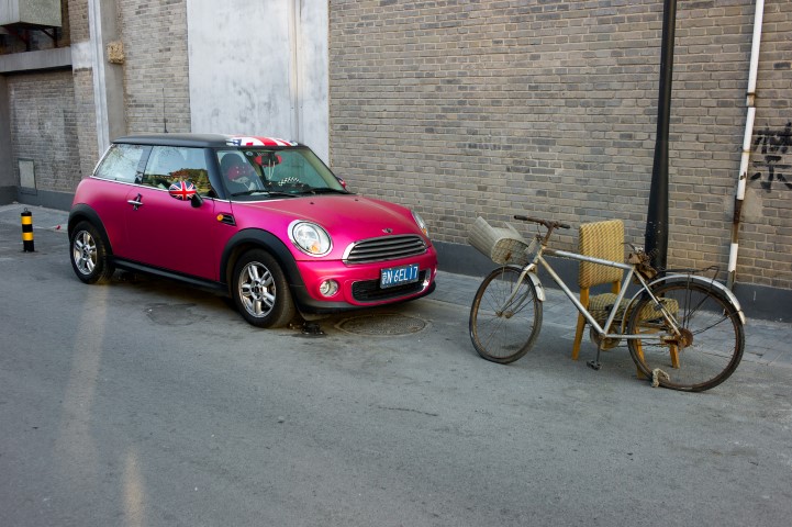
Since the new millennium, car culture has broken into China quickly and decisively. People who live in metropolitan cities, like Beijing, have grown accustomed to the convenience and comfort of a car and eagerly keep up with the latest models. Lost in the auto boom has been the humble, dependable

bicycle. The once iconic mode of transit has been severely marginalized in the modern city. Mainstream Chinese society has lost interest in the bicycle as a way of getting around in favor of the more glamorous automobiles. Rather than a universal cultural symbol, cycling has been reduced to a sign of the socially vulnerable groups in China.

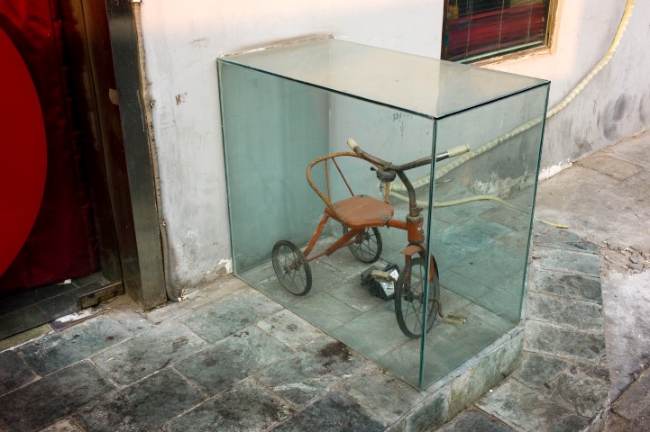
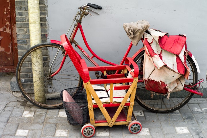
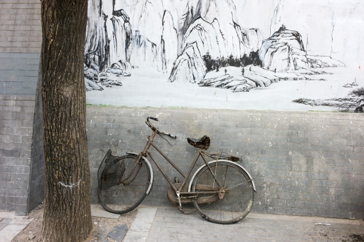
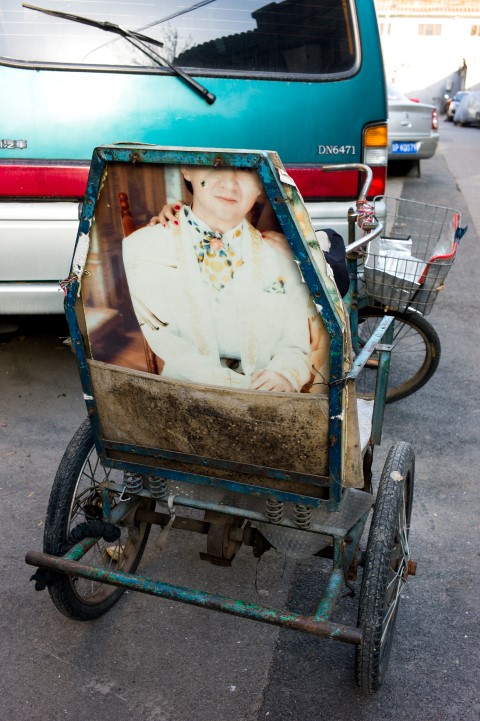
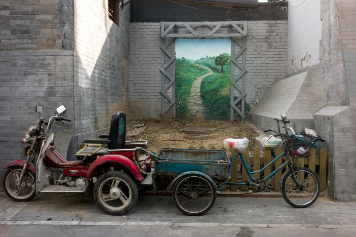
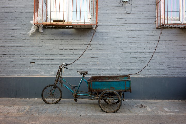
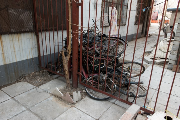
I began to wonder where all these bicycles are now. So, I set off in search of them, to discover where some of the once proud bicycles had ended up. Not surprisingly, many are dilapidated and rusty, having entirely lost their use. But some have managed to live on (a few in rather unique ways) as my series shows.

When I had the chance, I would ask the owners of some old bicycles how they felt about their fallen vehicles. Why did they hang on to these pitiful things? "Maybe one day I'll make use of it," they often replied. We all know that will never happen. But their answer reminded me of an old Beijing saying, "a dog's life is better than no life." The quote speaks for both the bicycles and their owners.

Bicycles are the witnesses and victims of a major societal transition in China. The present fate of these objects is a reflection of how the Chinese, as individuals, are coping with the seismic shifts that their lives, and their country, is undergoing every day.