


Z-AXIS
BY CHAN HONG YUI CLEMENT
Born in Hong Kong in 1992, Chan Hong Yui Clement is currently pursuing a Bachelor of Fine Arts in Photography at Savannah College of Art and Design. Chan connects photography to the larger field of art. He believes that a photograph is not a duplication of reality, but a subjective interpretation of it. In 2014, Chan was selected as the winning candidate of New Light V - an annual program that is organized by Lumenvisum and sponsored by the Hong Kong Arts Development Council to support talented young artists and provide them with an opportunity for a solo exhibition.
synopsis
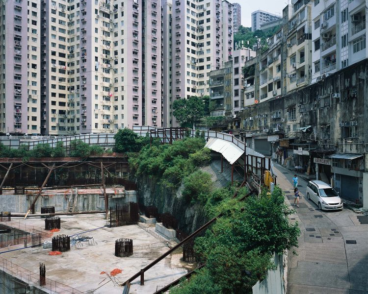
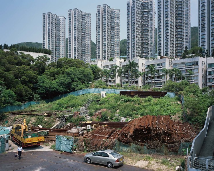
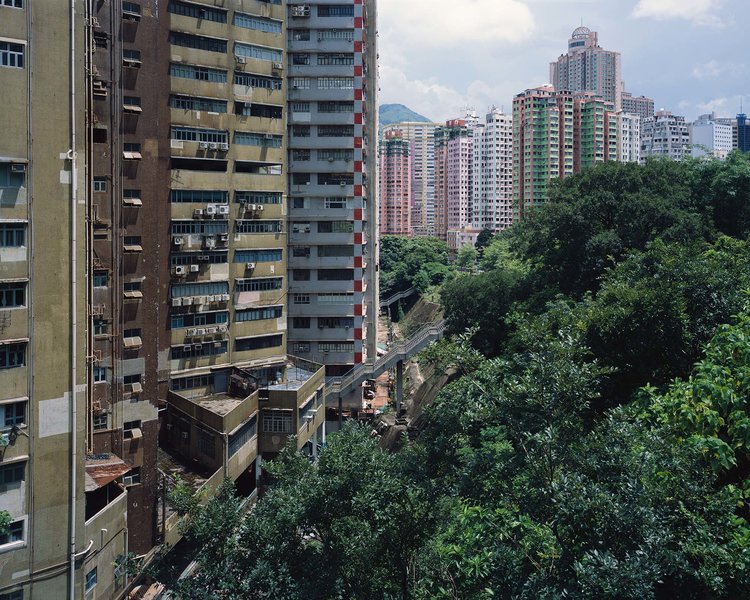
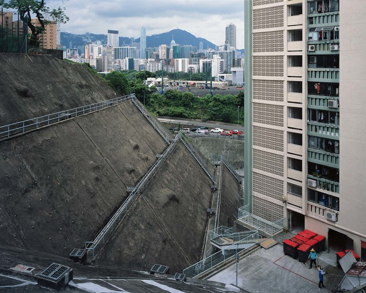
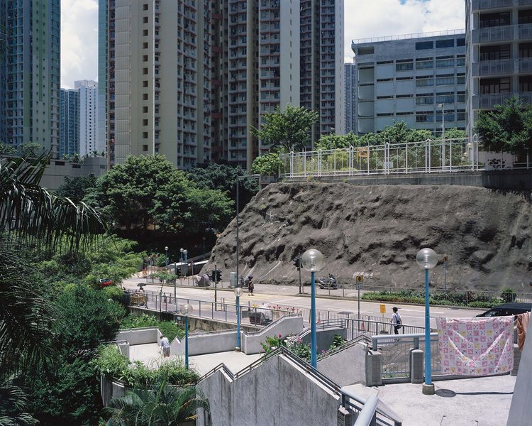
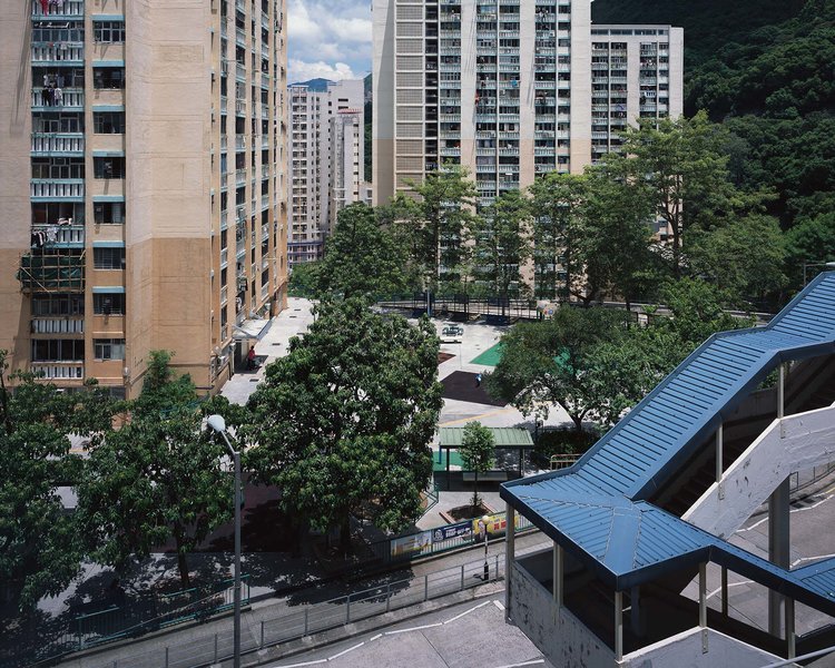
Hong Kong is situated on a hilly and mountainous terrain. Because of the lack of natural flat land, Hong Kong simply does not have the prerequisite to be designed into a grid system - a town planning method that is found in many other world cities such as New York. According to the Hong Kong Planning Department, about 47% of the land in Hong Kong lies above 100 mPD. Almost half of Hong Kong therefore has to be built on uplands, resulting in what is commonly known as a multi-level urban design.
Z-Axis aims at documenting the type of multi-level urban design that is shaped by the hilly and mountainous terrain in Hong Kong. Z-Axis, in mathematical terms, refers to the depth of an object in a three-dimensional coordinate system. Looking into the Hong Kong urban landscape along the Z-Axis, one can gain more understanding of (i) how the topographical factor impacts Hong Kong people’s habitation and (ii) to what extent the land has been altered in an attempt to adapt to the natural environment.
Through observing the Z-Axis the interrelationship between factor (i) and (ii) can be visualized and understood.
editor's note
Our aim is to disseminate and bring to light telling work of emergent or young photographers.